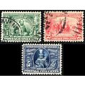
Map - Isle of Wight, c.1920 - G Dean Postcard
Notice from Seller : PayPal only. Postage is combined and is charged for the first item only. 20% discount for 10 or more items. 12% for 5-9 items. 8% for 2-4 items. Please wait for an invoice for multiple purchases. Signed For only if over £20.
- Condition : Used
- Dispatch : 2 Days
- Brand : None
- ID# : 224656429
- Quantity : 1 item
- Views : 29
- Location : United Kingdom

- Seller : Vibracobra23 (+118)
- Barcode : None
- Start : Sat 09 Nov 2024 06:30:45 (EDT)
- Close : Run Until Sold
- Remain : Run Until Sold
International Shipping to United States  for 1 item(s) edit
for 1 item(s) edit
Royal Mail International Standard = £3.20 ($4.33)
Royal Mail International Tracked = £8.10 ($10.95)
Royal Mail International Tracked = £8.10 ($10.95)
Shipping Calculator
More Listings from This Seller view all


Seller's Description
Printed colour postcard showing the Ordnance Survey 6 miles to 1 inch map of the Isle of Wight by The Mappa Co, London.
Published by G. Dean, Sandown, not numbered, c.1920.
Postally unused, but with lengthy notes in pencil.
Good condition, with slight corner bumps, but slight knock to top right corner.
K668
Listing Information
| Listing Type | Gallery Listing |
| Listing ID# | 224656429 |
| Start Time | Sat 09 Nov 2024 06:30:45 (EDT) |
| Close Time | Run Until Sold |
| Starting Bid | Fixed Price (no bidding) |
| Item Condition | Used |
| Bids | 0 |
| Views | 29 |
| Dispatch Time | 2 Days |
| Quantity | 1 |
| Location | United Kingdom |
| Auto Extend | No |
Seller Recent Feedback
Returns Policy
Returns Accepted
Buyer to pay postage costs.