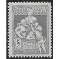
Thurso, Caithness, Highland - Beach & Promenade - Colourmaster postcard 1970s
- Condition : Used
- Dispatch : 2 Days
- Brand : None
- ID# : 140780675
- Quantity : 1 item
- Views : 149
- Location : United Kingdom

- Seller : justthebook (+1703)
- Barcode : None
- Start : Mon 06 Jul 2015 21:40:44 (BST)
- Close : Run Until Sold
- Remain : Run Until Sold
 for 1 item(s)
More Listings from This Seller view all


Seller's Description
- Postcard
- Picture / Image: Beach and Promenade, Thurso, Caithness, Highland region
- Publisher: Colourmaster International (Photo Precision) PT36996
- Postally used: no
- Stamp: n/a
- Postmark(s): n/a
- Sent to: n/a
- Notes / condition:
Please ask if you need any other information and I will do the best I can to answer.
Image may be low res for illustrative purposes - if you need a higher definition image then please contact me and I may be able to send one. No cards have been trimmed (unless stated).
------------------------------------------------
Postage & Packing:
Postage and packing charge should be showing for your location (contact if not sure).
No additional charges for more than one postcard. You can buy as many postcards from me as you like and you will just pay the fee above once. Please wait for combined invoice. (If buying postcards with other things such as books, please contact or wait for invoice before paying).
Payment Methods:
UK - PayPal, Cheque (from UK bank) or postal order
Outside UK: PayPal ONLY (unless otherwise stated) please. NO non-UK currency checks or money orders (sorry).
NOTE: All postcards are sent in brand new stiffened envelopes which I have bought for the task. These are specially made to protect postcards and you may be able to re-use them. In addition there are other costs to sending so the above charge is not just for the stamp!
I will give a full refund if you are not fully satisfied with the postcard.
----------------------------------------------
Text from the free encyclopedia WIKIPEDIA may appear below to give a little background information (internal links may not work) :
*************
Thurso[1] (Scots: Thursa,[2] Scottish Gaelic: Inbhir Theòrsa)[3] is a town and former burgh on the north coast of the Highland council area of Scotland. It is the northernmost town on the British mainland. At the 2011 Census, Thurso had a population of 7,933. The larger Thurso civil parish including the town and the surrounding countryside had a population of 9,112.
Historically, it is one of two burghs within the county of Caithness. It lies at the junction of the north-south A9 road and the west-east A836 road, connected to Bridge of Forss in the west and Castletown in the east.
The earliest recorded name is the Celtic Tarvodubron, 'bull water', which became Thjorsá in the Norse translation, but owing to the frequency of Thor in place names, this was later adapted to Thorsá or 'Thor's River.'[4] It was also known as Tarvodunum in old Celtic, meaning ""fort of the bull"".
The local Scots name, ""Thursa"", derives from the Norse, as does the modern Scottish Gaelic ""Inbhir Theòrsa"" (The ""th"" is pronounced as ""h"" and the ""bh"" as ""v"".). Inbhir means a river mouth, and is generally found as ""Inver"" in many anglicised names. It is possible that there was also a pre-Norse Gaelic name as well, as ""tarvodunum"" and ""tarvodunum"" are cognate with the modern Gaelic terms, ""tarbh"" (bull), ""dobhran"" and ""dun"".
Thurso's history stretches back to at least the era of Norse Orcadian rule in Caithness, which ended conclusively in 1266. The town was an important Norse port, and has a later history of trade with ports throughout northern Europe until the 19th century. In 1330 Scotland's standard unit of weight was brought in line with that of Thurso at the decree of King David II of Scotland, a measure of the town's economic importance. Old St Peter's Kirk is said to date from circa 1220 and the time of Caithness Bishop Gilbert Murray, who died in 1245. Much of the town, however, is a planned 19th-century development. A major expansion occurred in the mid-20th century when the Dounreay nuclear power plant was established at Dounreay,[5] 9 miles (14 km) to the west of the town. Within a period of about five years, Thurso's population expanded rapidly, from around 2,500 to about 12,000 between 1955–58, as the nuclear plant attracted skilled migrants from all parts of the United Kingdom. By 1960, it dropped back to around 9,000, after a lot of the initial Dounreay construction crew left the area. Thurso is also the name of the viscountcy held by the Sinclair family in the Peerage of the United Kingdom. The present Viscount Thurso is also the local MP.
Thurso hosted the National Mod several times in 2010.[6]
Thurso has history as a burgh of barony dating from 1633.
In 1975, under the Local Government (Scotland) Act 1973, the local government burgh was merged into the Caithness district of the two-tier Highland region. In 1996, under the Local Government etc (Scotland) Act 1994, the district was abolished and the region became a unitary council area.
From 1996 until 2007, the town of Thurso was covered by two or three wards, each electing one councillor by the first past the post system of election. In 2007, a single Thurso ward was created to elect three councillors by the single transferable vote system. The new ward is one of three within the Highland Council's Caithness ward management area and one of seven within the council's Caithness, Sutherland and Easter Ross corporate management area.
There is also Thurso Community Council, which was created in 1975 when the burgh was abolished. The community council is not a tier of local government, but it is recognised as a level of statutory representation. The community council represents an area which is somewhat smaller than that represented by ward councillors. The ward area also includes parts of other community council areas.
Thurso is the most northerly town on the British mainland, situated on the northern coastline overlooking the Orkney Islands. It is situated at the northern terminus of the A9 road, the main road linking Caithness with the south of Scotland, and is 20 miles (32 km) west of John o' Groats and 21 miles (34 km) northwest of Wick, the closest town.
type=printed
city/ region=thurso
period=post-war (1945-present)
postage condition=unposted
number of items=single
size=standard (140x89 mm)
Listing Information
| Listing Type | Gallery Listing |
| Listing ID# | 140780675 |
| Start Time | Mon 06 Jul 2015 21:40:44 (BST) |
| Close Time | Run Until Sold |
| Starting Bid | Fixed Price (no bidding) |
| Item Condition | Used |
| Bids | 0 |
| Views | 149 |
| Dispatch Time | 2 Days |
| Quantity | 1 |
| Location | United Kingdom |
| Auto Extend | No |