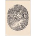
Thurne Dyke, Norfolk Broads - Cotman-Color Jarrold postcard c.1970s
- Condition : Used
- Dispatch : 2 Days
- Brand : None
- ID# : 122803687
- Quantity : 1 item
- Views : 734
- Location : United Kingdom

- Seller : justthebook (+1703)
- Barcode : None
- Start : Wed 04 Dec 2013 11:01:01 (BST)
- Close : Run Until Sold
- Remain : Run Until Sold
More Listings from This Seller view all
Seller's Description
- Postcard
- Picture / Image: Thurne Dyke, Norfolk Broads
- Publisher: Cotman-Color (Jarrold)
- Postally used: no
- Stamp: n/a
- Postmark(s): n/a
- Sent to: n/a
- Notes / condition:
Please ask if you need any other information and I will do the best I can to answer.
Image may be low res for illustrative purposes - if you need a higher definition image then please contact me and I may be able to send one.
------------------------------------------------
Postage & Packing:
UK (incl. IOM, CI & BFPO): 99p
Europe: £1.60
Rest of world (inc. USA etc): £2.75
No additional charges for more than one postcard. You can buy as many postcards from me as you like and you will just pay the fee above once. (If buying postcards with other things such as books, please contact or wait for invoice before paying).
Payment Methods:
UK - PayPal, Cheque (from UK bank) or postal order
Outside UK: PayPal ONLY (unless otherwise stated) please. NO non-UK currency checks or money orders (sorry).
NOTE: All postcards are sent in brand new stiffened envelopes which I have bought for the task. These are specially made to protect postcards and you may be able to re-use them. In addition there are other costs to sending so the above charge is not just for the stamp!
I will give a full refund if you are not fully satisfied with the postcard.
----------------------------------------------
Text from the free encyclopedia WIKIPEDIA may appear below to give a little background information (internal links may not work) :
*************
The River Thurne is a river in Norfolk, England in The Broads.[1] Just six miles (10 km) long it rises two miles (3 km) from the coast near Martham Broad and is navigable from West Somerton. It flows southwest and is linked by Candle Dyke and Heigham Sound to both Horsey Mere and Hickling Broad. It continues southwest and flows through Potter Heigham (passing under its medieval bridge) and enters the River Bure just south of Thurne dyke, near St. Benet's Abbey.
Much of the River Thurne system is navigable, but there are a number of restrictions to the size of boats that can use it. The most famous is the medieval bridge at Potter Heigham. Most road traffic now uses the A149 Bypass, slightly to the north, but the narrow central arch restricts passage to boats needing headroom of less than 6.6 feet (2.0 m), and is the lowest bridge on the Broads. In addition, the river is still tidal here, and although the rise and fall is only about 6 inches (15 cm), currents through the bridge are quite strong. It is a requirement that all hire craft take on a pilot before they pass under the bridge.[2]
Above Potter Heigham, the river is joined by Candle Dyke, which connects to Heigham Sound, from which White Slea Mere leads on to Hickling Broad, where there are moorings. Both Heigham Sound and Hickling Broad are quite shallow, and the navigation channels are clearly marked. Hickling Broad is also a National Nature Reserve. From Heigham Sound, Meadow Dyke leads northwards to Horsey Mere, most of which is a National Trust nature reserve. The National Trust also own Horsey Drainage Mill. Beyond Horsey Mere lies Waxham New Cut, along which boats up to 30 feet (9.1 m) long can travel for about 1.5 miles (2.4 km) to Lound Bridge. The sea is less than 1 mile (1.6 km) from the bridge at this point, although it is 26 miles (42 km) away by boat.[2]
The main river is navigable almost to its source. The channel passes between the parts of Martham Broad, which is a nature reserve owned by the Norfolk Wildlife Trust, to reach West Somerton staithes. The staithes are at the end of a dyke cut from Martham Broad to the village.[2]
Below Potter Heigham, Womack Water is navigable to Ludham, about 1 mile (1.6 km) from the main channel, but is only 4 feet (1.2 m) deep. Navigation is restricted to boats under 46 feet (14 m) in length. Thurne Dyke, a little further below that, is only 3 feet (0.9 m) deep and can be navigated for 170 yards (160 m) to the village of Thurne.[2]
type=printed postcards
theme=topographical: british
sub-theme=england
county/ country=norfolk
number of items=single
period=1945 - present
postage condition=unposted
Listing Information
| Listing Type | Gallery Listing |
| Listing ID# | 122803687 |
| Start Time | Wed 04 Dec 2013 11:01:01 (BST) |
| Close Time | Run Until Sold |
| Starting Bid | Fixed Price (no bidding) |
| Item Condition | Used |
| Bids | 0 |
| Views | 734 |
| Dispatch Time | 2 Days |
| Quantity | 1 |
| Location | United Kingdom |
| Auto Extend | No |


 for 1 item(s)


