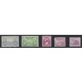
Singapore - mouth of river, Anderson Bridge - postcard by SW (S7645) c.1970s
- Condition : Used
- Dispatch : 2 Days
- Brand : None
- ID# : 188479372
- Quantity : 1 item
- Views : 212
- Location : United Kingdom

- Seller : justthebook (+1703)
- Barcode : None
- Start : Tue 14 Jan 2020 11:48:25 (BST)
- Close : Run Until Sold
- Remain : Run Until Sold
 for 1 item(s)
More Listings from This Seller view all


Seller's Description
- Postcard
- Picture / Image: The Mouth of the Singapore River spanned by the Anderson Bidge with Fullerton Building in background
- Publisher: SW (S7645)
- Postally used: no
- Stamp: n/a
- Postmark(s): n/a
- Sent to: n/a
- Notes / condition:
Please ask if you need any other information and I will do the best I can to answer.
Image may be low res for illustrative purposes - if you need a higher definition image then please contact me and I may be able to send one. No cards have been trimmed (unless stated).
------------------------------------------------
Postage & Packing:
Postage and packing charge should be showing for your location (contact if not sure).
No additional charges for more than one postcard. You can buy as many postcards from me as you like and you will just pay the fee above once. Please wait for combined invoice. (If buying postcards with other things such as books, please contact or wait for invoice before paying).
Payment Methods:
UK - PayPal, Cheque (from UK bank) or postal order
Outside UK: PayPal ONLY (unless otherwise stated) please. NO non-UK currency checks or money orders (sorry).
NOTE: All postcards are sent in brand new stiffened envelopes which I have bought for the task. These are specially made to protect postcards and you may be able to re-use them. In addition there are other costs to sending so the above charge is not just for the stamp!
I will give a full refund if you are not fully satisfied with the postcard.
----------------------------------------------
Text from the free encyclopedia WIKIPEDIA may appear below to give a little background information (internal links may not work) :
*************
The Singapore River (Malay: Sungei Singapura, Chinese: 新加坡河) is a river that runs parallel to Alexandra Road and feeds into the Marina Reservoir in the southern part of Singapore. The immediate upper watershed of the Singapore River is known as the Singapore River Planning Area, although the northernmost part of the watershed is classified under River Valley planning area.
Singapore River planning area sits within the Central Area of the Central Region of Singapore, as defined by the Urban Redevelopment Authority. The planning area shares boundaries with the following - River Valley and Museum to the north, Tanglin and Bukit Merah to the west, Outram to the south and the Downtown Core to the east.
The Singapore River is approximately 3.2 kilometers long[1] from its source at Kim Seng Bridge to where it empties into Marina Bay; the river extends more than two kilometers beyond its original source at Kim Seng Bridge as Alexandra Canal, as far as the junction of Commonwealth Avenue.[citation needed]
The mouth of the Singapore River was the old Port of Singapore, being naturally sheltered by the southern islands. Historically, the city of Singapore initially grew around the port so the river mouth became the centre of trade, commerceand finance.
At one time, Singapore River was the very lifeblood of the colony, the trade artery, the center of commercial activity, the heart of entrepot trade, the vessel of importance, the capillaries of life and the place which was frequented by the secret societies, the swaylos (Cantonese for coolies who worked on a boat) and the coolies who worked for the philanthropist Tan Tock Seng at Ellenborough Market and the towkay (Hokkien for business owner) Tan Kim Seng who was busy filling his godown with the riches of the East.
Singapore River is where the colourful and romantic history of the river and the myths and legends can still conjure up memories of the lighters, bumboats, tongkangs with their painted eyes to see the danger ahead and sampans of yesteryear. This is where the Malayan princes once sailed and this is where the bullock carts plodded their way up and down each bank as the river found its way to the former rocky river mouth. This is also where an early civilisation was conquered by the Javanese Majapahit Empire, in the year 1376.
Some of the temples, shrines and other places of worship still stand in the vicinity of the river. Bridges such as Anderson Bridge, Elgin Bridge and Cavenagh Bridge still remain, the Merlion, the shophouses, and the large trees such as Banyan and Madras Thorn. Some parts of this area include quays such as Clarke Quay, Boat Quay and Robertson Quay, which generated trade and extensive demand for services with the boats that landed at the quays. Boat Quay itself was handling three quarters of the shipping service in the 1860s. Shophouses and warehouses flourished around the quays due to their proximity to trade during the colonial era, but presently house various bars, pubs and restaurants, as well as antique shops.
The river still borders places where seamen and others, for example, near Raffles Landing Place, made offerings and burned their joss sticks. Poles with streamers flying were once used to tie up the barges as the water lapped against the old stone stepsand walls.
Sir Stamford Raffles lost no time after January 1819, when he landed on Singapore River among the orang laut, in bargaining with the Temenggong, the Johor chief who then ruled the place, having settled in 1811. At the very moment of landing, Raffles must have realised the importance of the river for, in the same year of 1819, the north bank was drained for government buildings and, in 1822, the south bank was reclaimed and a retaining wall and steps were built.
Robertson Quay along the banks of the Singapore River
Through lack of knowledge or foresight, the bridges were constructed too low and the river was too shallow for the demands that were to be made on its use. This historic river, which Raffles had fashioned from salt marshes, sand bars and mangrove swamps, has witnessed the British rule and the Japanese occupation, and has supported years of economic activity by the Chinese, Malays, Indians and others. However, with the expansion of trade came congestion and pollution.
Old maps of the river state that it actually originates from Bukit Larangan (currently Fort Canning Hill).
Listing Information
| Listing Type | Gallery Listing |
| Listing ID# | 188479372 |
| Start Time | Tue 14 Jan 2020 11:48:25 (BST) |
| Close Time | Run Until Sold |
| Starting Bid | Fixed Price (no bidding) |
| Item Condition | Used |
| Bids | 0 |
| Views | 212 |
| Dispatch Time | 2 Days |
| Quantity | 1 |
| Location | United Kingdom |
| Auto Extend | No |