Eyre Highway, Western Australia - Nullabor Crossing - postcard c.1970s
- Condition : Used
- Dispatch : 2 Days
- Brand : None
- ID# : 186926091
- Quantity : 1 item
- Views : 444
- Location : United Kingdom

- Seller : justthebook (+1704)
- Barcode : None
- Start : Thu 14 Nov 2019 14:16:38 (BST)
- Close : Run Until Sold
- Remain : Run Until Sold
 for 1 item(s)
More Listings from This Seller view all


Seller's Description
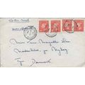
- Postcard
- Picture / Image: The Nullabor Crossing, Eyre Highway [Western Australia / South Australia]
- Publisher: Mige Distributors, Perth, WA
- Postally used: no
- Stamp: n/a
- Postmark(s): n/a
- Sent to: n/a
- Notes / condition:
Please ask if you need any other information and I will do the best I can to answer.
Image may be low res for illustrative purposes - if you need a higher definition image then please contact me and I may be able to send one. No cards have been trimmed (unless stated).
------------------------------------------------
Postage & Packing:
Postage and packing charge should be showing for your location (contact if not sure).
No additional charges for more than one postcard. You can buy as many postcards from me as you like and you will just pay the fee above once. Please wait for combined invoice. (If buying postcards with other things such as books, please contact or wait for invoice before paying).
Payment Methods:
UK - PayPal, Cheque (from UK bank) or postal order
Outside UK: PayPal ONLY (unless otherwise stated) please. NO non-UK currency checks or money orders (sorry).
NOTE: All postcards are sent in brand new stiffened envelopes which I have bought for the task. These are specially made to protect postcards and you may be able to re-use them. In addition there are other costs to sending so the above charge is not just for the stamp!
I will give a full refund if you are not fully satisfied with the postcard.
----------------------------------------------
Text from the free encyclopedia WIKIPEDIA may appear below to give a little background information (internal links may not work) :
*************
Eyre Highway is a 1,660-kilometre (1,030 mi) highway linking Western Australia and South Australia via the Nullarbor Plain. Signed as National Highways 1 and A1, it forms part of Highway 1 and the Australian National Highway network linking Perth and Adelaide. It was named after explorer Edward John Eyre, who was the first European to cross the Nullarbor by land, in 1840–1841. Eyre Highway runs from Norseman in Western Australia, past Eucla, to the state border. Continuing to the South Australian town of Ceduna, it then crosses the top of the Eyre Peninsula before reaching the city of Port Augusta in South Australia.
The construction of the East–West Telegraph line in the 1870s, along Eyre's route, resulted in a hazardous trail that could be followed for interstate travel. A national highway was called for, but the federal government did not see the route as important enough until 1941, when a war in the Pacific seemed imminent. The highway was constructed between July 1941 and June 1942, but was trafficable by January 1942. Though originally named Forrest Highway, after John Forrest, by the war cabinet, it was officially named and gazetted Eyre Highway, a name agreed upon by the states' nomenclature committees.
The finished road, while an improvement over the previous route, still was not much more than a track, and remained such throughout the 1940s and 1950s. Efforts to seal the highway began in Norseman in 1960, with the Western Australian section completed in 1969 and the South Australian section finished in 1976. Further improvement works have been undertaken since the 1980s, including widening and reconstructing portions of the road.
Eyre Highway is the only sealed road linking the states of Western Australia and South Australia,[2] running east from Norseman in Western Australia for 1,200 kilometres (750 mi) across the Nullarbor Plain to Ceduna, South Australia. It then crosses the top of the Eyre Peninsula as it continues eastwards for 470 kilometres (290 mi), before reaching the city of Port Augusta.[3] Eyre Highway is part of the National Highway route between Perth and Adelaide, and also forms part of Australia's Highway 1. It is signed as National Highway 1 in Western Australia,[4] and National Highway A1 in South Australia.[5][6] The vast majority of the highway is a two-lane single carriageway[3] with a speed limit of 110 kilometres per hour (70 mph), except in and around built up areas.[7][8] Road trains (A-double or B-triple) up to 36.5 metres (120 ft) are permitted on Eyre Highway,[9] but are limited to the slightly lower maximum speed of 100 kilometres per hour (62 mph).[10]
The Western Australian section of Eyre Highway is on the western side of the Nullarbor Plain; the South Australian section crosses the eastern section of the Nullarbor Plain, and the top of the Eyre Peninsula. The Nullarbor gets its name from Latin for "no tree",[11] and the typical view is that of a straight highway and practically unchanging flat saltbush-covered terrain,[12] although some parts are located on ridges. The Eyre Peninsula has been extensively cleared for agriculture, although there are remnant corridors of native eucalyptus woodland alongside its roads.[13]
Main Roads Western Australia and the Department of Planning, Transport and Infrastructure in South Australia monitor traffic volume across the states' road networks, including various locations along Eyre Highway.[14]:3[15] In Western Australia, the recorded traffic volumes ranged between 430 and 760 vehicles per day in 2013/14.[14]:5 In South Australia, the estimated annual average daily traffic as of September 2015 varied between 500 and 1500 west of Lincoln Highway, and was 2700 to the east.[16]
Eyre Highway was assessed by the Australian Automobile Association in 2011 to be among the lowest risk highways in the country, based on total number of casualty crashes[a] per length of road. However, individual risk based on casualty crash rates per vehicle kilometre travelled was assessed as high for the 95-kilometre (59 mi) section east of Yalata to Fowlers Bay, medium for a 106-kilometre (66 mi) section from Fowlers Bay to Ceduna, low-medium between Ceduna and Port Augusta, and low west of Yalata.[17] In 2013, Eyre Highway similarly received a lower safety rating for the South Australian sections, compared to the Western Australian section. Out of five stars, approximately 10% was rated as one- or two-star in Western Australia, generally towards the Norseman end, and 91% was rated three- or four-star. In South Australia, 49% was rated as one- or two-star, mostly from Yalata to Ceduna, and across the Eyre Peninsula, with the remaining 51% rated as three- or four-star.[18]
Listing Information
| Listing Type | Gallery Listing |
| Listing ID# | 186926091 |
| Start Time | Thu 14 Nov 2019 14:16:38 (BST) |
| Close Time | Run Until Sold |
| Starting Bid | Fixed Price (no bidding) |
| Item Condition | Used |
| Bids | 0 |
| Views | 444 |
| Dispatch Time | 2 Days |
| Quantity | 1 |
| Location | United Kingdom |
| Auto Extend | No |