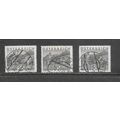
Curaçao, Dutch Caribbean - Pontoon Bridge - postcard by Dexter c.1960s
- Condition : Used
- Dispatch : 2 Days
- Brand : None
- ID# : 183407975
- Quantity : 1 item
- Views : 229
- Location : United Kingdom

- Seller : justthebook (+1703)
- Barcode : None
- Start : Thu 18 Jul 2019 00:13:06 (BST)
- Close : Run Until Sold
- Remain : Run Until Sold
 for 1 item(s)
More Listings from This Seller view all


Seller's Description
- Postcard
- Picture / Image: Famous Pontoon Bridge closing after ship passed through entering Curaçao harbour [in the Dutch Caribbean]
- Publisher: Dexter Press Inc.
- Postally used: no
- Stamp: n/a
- Postmark(s): n/a
- Sent to: n/a
- Notes / condition:
Please ask if you need any other information and I will do the best I can to answer.
------------------------------------------------
Postage and packing charge should be showing for your location (contact if not sure).
UK - PayPal, Cheque (from UK bank) or postal order
I will give a full refund if you are not fully satisfied with the postcard.
----------------------------------------------
Curaçao (/ˈkjʊərəsoʊ/;[6] Dutch: Curaçao, pronounced [kyːraːˈsʌu, kuː-];[7] Papiamento: Kòrsou, pronounced [ˈkorsou]) is a Lesser Antilles island in the southern Caribbean Sea and the Dutch Caribbean region, about 65 km (40 mi) north of the Venezuelan coast. It is a constituent country (Dutch: land) of the Kingdom of the Netherlands.
The country was formerly part of the Curaçao and Dependencies colony (1815–1954) and is now formally called the Country of Curaçao (Dutch: Land Curaçao;[8] Papiamento: Pais Kòrsou);[9] it includes the main island of Curaçao and the uninhabited island of Klein Curaçao ("Little Curaçao"). Curaçao has a population over 160,000 in an area of 444 km2(171 sq mi) and its capital is Willemstad.
Before the dissolution of the Netherlands Antilles on 10 October 2010, Curaçao was administered as the "Island Territory of Curaçao"[10] (Dutch: Eilandgebied Curaçao, Papiamento: Teritorio Insular di Kòrsou), one of five island territories of the former Netherlands Antilles.
The Queen Emma Bridge, a 168 metres (551 ft) long pontoon bridge, connects pedestrians between the Punda and Otrobanda districts.[87] This swings open to allow the passage of ships to and from the port.[88] The bridge was originally opened in 1888 and the current bridge was installed in 1939.[89] It is best known and, more often than not, referred to by the locals as "Our Swinging Old Lady".[90]
The Queen Juliana Bridge connects mobile traffic between the same two districts. At 185 feet (56 m) above the sea, it is one of the highest bridges in the Caribbean.[88]
Listing Information
| Listing Type | Gallery Listing |
| Listing ID# | 183407975 |
| Start Time | Thu 18 Jul 2019 00:13:06 (BST) |
| Close Time | Run Until Sold |
| Starting Bid | Fixed Price (no bidding) |
| Item Condition | Used |
| Bids | 0 |
| Views | 229 |
| Dispatch Time | 2 Days |
| Quantity | 1 |
| Location | United Kingdom |
| Auto Extend | No |