Coldbackie, Sutherland, Highland - Tongue Bay, Rabbit Islands - Dixon postcard
- Condition : Used
- Dispatch : 2 Days
- Brand : None
- ID# : 143196622
- Quantity : 1 item
- Views : 712
- Location : United Kingdom

- Seller : justthebook (+1713)
- Barcode : None
- Start : Sat 26 Sep 2015 10:22:16 (BST)
- Close : Run Until Sold
- Remain : Run Until Sold
 for 1 item(s)
More Listings from This Seller view all


Seller's Description
- Postcard
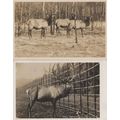
- Picture / Image: Coldbackie, Sutherland [Highland] - Coldbackie Sands with Tongue Bay and the Rabbit Islands
- Publisher: J Arthur Dixon (PSC/22731)
- Postally used: no
- Stamp: n/a
- Postmark(s): n/a
- Sent to: n/a
- Notes / condition:
Please ask if you need any other information and I will do the best I can to answer.
Image may be low res for illustrative purposes - if you need a higher definition image then please contact me and I may be able to send one. No cards have been trimmed (unless stated).
------------------------------------------------
Postage & Packing:
Postage and packing charge should be showing for your location (contact if not sure).
No additional charges for more than one postcard. You can buy as many postcards from me as you like and you will just pay the fee above once. Please wait for combined invoice. (If buying postcards with other things such as books, please contact or wait for invoice before paying).
Payment Methods:
UK - PayPal, Cheque (from UK bank) or postal order
Outside UK: PayPal ONLY (unless otherwise stated) please. NO non-UK currency checks or money orders (sorry).
NOTE: All postcards are sent in brand new stiffened envelopes which I have bought for the task. These are specially made to protect postcards and you may be able to re-use them. In addition there are other costs to sending so the above charge is not just for the stamp!
I will give a full refund if you are not fully satisfied with the postcard.
----------------------------------------------
Text from the free encyclopedia WIKIPEDIA may appear below to give a little background information (internal links may not work) :
*************
Coldbackie (Scottish Gaelic: Callbacaidh) is a crofting township in Sutherland and is in the Scottish council area of Highland Scotland.
Coldbackie lies at the mouth of the Kyle of Tongue, 2 miles (3.2 km) north east of Tongue. It sits under Cnoc an Fhreiceadain (the Watch Hill), looking north across Tongue Bay to the Rabbit Islands. It is one of a series of townships, running from Tongue along the A836 to Blandy. The township of Scullomie is 1 mile (1.6 km) to the north.
Cnoc an Fhreiceadain has dramatic Old Red Sandstone conglomorate cliffs, and impressive views along the north coast of Scotland, from Durness to Orkney.
The name Coldbackie could have old Norse or Gaelic roots. The place name Coldbackie is not unique to the Kyle of Tongue, with there being two Coldbacks in Shetland (in Unst and Delting) and one in north west Iceland, both areas where Norse roots would be more likely. Omand, in The Sutherland book, translates Coldbackie as kula-bakki, bank with the bump, whilst Stewart, in Place names of Shetland says that Coldbacks is Cold Hill.
The Kyle of Tongue (Scottish Gaelic: Caol Thunga) is a shallow sea loch[1] in northwest Highland, Scotland, in the western part of the former county of Sutherland. Featuring a rocky coastline, its mouth is formed at Tongue Bay. The community of Tongue is situated on the Kyle's eastern shore and the loch is crossed by the Kyle of Tongue Bridge and Causeway. Nearby are Ben Hope and Ben Loyal.
According to the Origines Parochiales Scotiae, Castle Varrich, an old square tower on a hill on the east side of the Kyle, was the residence of Karl Hundason, who made an effort to conquer Scotland on the death of Malcolm II.[2] There are three brochs: on the Kyle's east side opposite Melness; at the head of the Kyle; and at Dunbuie, a hill on the west side of the Kyle.[3]
In 1746, a naval engagement occurred at the Kyle involving Bonnie Prince Charlie's Jacobite rebellion.[4] The Jacobite ship Le Prince Charles, commanded by Captain Richard Talbot, was bringing a large amount of French gold to aid the Jacobite cause. It was chased by a British squadron and one of the Royal Navy frigates eventually caught up with it in the Kyle of Tongue, on 25 February 1746. A fierce five hour battle took place: the Jacobite ship fought bravely, but in the end was defeated. The failure of the gold to reach the Prince’s army was one of the main factors which led to the Battle of Culloden.[5]
Kyle of Tongue is situated 8 miles (13 km) east of Loch Eriboll. Its western entrance is between Cnoc Glass and Roan Island; the eastern entrance is between Rosin Island and Neave Island. From Roan Island, the kyle trends in a south and southwest direction for 7 miles (11 km) to Kinloch. A large portion of it is sandy, with a narrow bar-encumbered channel running through it. The depths range from approximately 18 fathoms west of Roan Island to 5 fathoms in the area 1.5 miles (2.4 km) above where the shallows begin. There is no channel into the Kyle of Tongue along the western shore.[6] Derry (or Loch an Dithreibh) is a lake which empties into the head of the Kyle of Tongue.[7] Strathtongue, a 8 miles (13 km) long stream, runs to the Kyle.[8]
Rabbit Islands
are a group of three uninhabited small islands off the north coast of Sutherland, Scotland in Tongue Bay. In Scottish Gaelic, and occasionally in English, they are known as Eileanan nan Gall, which is sometimes anglicised as ""Eilean-na-Gaeil"" [1] or ""Eilean nan Gaill"".[1]The islands' modern name derives from their sandy soil, which favours rabbit burrows and makes their presence particularly obvious [2]. They are fairly low lying, slender in shape, and along with the surrounding fjard of Tongue Bay, they show the effects of former glaciation. They are made up of sandstone.
The northernmost of the group is called Sgeir an Òir, and there is a natural arch at its north end called ""Claigeann na Sgeir"" (Bell of the Skerry)
They are near Coldbackie, Melness and Talmine on the mainland, and Eilean nan Ròn is to the north east. They are in the parish of Tongue.[3]
The islands' older name ""Eileanan nan Gall"", means ""islands of the strangers"", or ""Norsemen"".[1]
Supposedly, a ship carrying gold to Charles Edward Stuart was wrecked on the island.[2] The northernmost of the group is called Sgeir an Òir (skerry of the gold), which is perhaps a reference to this.
Currently, the islands are popular with scuba divers, and have in the past been used for grazing.
type=printed
city/ region=coldbackie
period=post-war (1945 - present)
postage condition=unposted
number of items=single
size=continental/ modern (150x100mm)
Listing Information
| Listing Type | Gallery Listing |
| Listing ID# | 143196622 |
| Start Time | Sat 26 Sep 2015 10:22:16 (BST) |
| Close Time | Run Until Sold |
| Starting Bid | Fixed Price (no bidding) |
| Item Condition | Used |
| Bids | 0 |
| Views | 712 |
| Dispatch Time | 2 Days |
| Quantity | 1 |
| Location | United Kingdom |
| Auto Extend | No |