Castlemartin, Pembrokeshire Green Bridge of Wales 70s
- Condition : Used
- Dispatch : 2 Days
- Brand : None
- ID# : 36534486
- Quantity : 1 item
- Views : 396
- Location : United Kingdom

- Seller : justthebook (+1703)
- Barcode : None
- Start : Thu 30 Dec 2010 13:06:04 (BST)
- Close : Run Until Sold
- Remain : Run Until Sold
 for 1 item(s)
More Listings from This Seller view all


Seller's Description
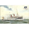
- Postcard
- Picture / Image: The Green Bridge of Wales (rock formations), Castlemartin
- Publisher: Archway
- Postally used: yes
- Stamp: Welsh regional 12p green
- Postmark(s): Tenby October 1980 wavy line
- Sent to: Front Street, Kingwold, nr Deal, Kent
- Notes & Key words:
------------------------------------------------
Postage & Packing:
UK (incl. IOM, CI & BFPO): 99p
Europe: £1.60
Rest of world (inc. USA etc): £2.75
No additional charges for more than one postcard. You can buy as many postcards from me as you like and you will just pay the fee above once. (If buying postcards with other things such as books, please contact or wait for invoice before paying).
Payment Methods:
UK - PayPal, Cheque (from UK bank) or postal order
Outside UK: PayPal or Google Checkout ONLY please. NO non-UK currency checks or money orders (sorry).
NOTE: All postcards are sent in brand new stiffened envelopes which I have bought for the task. These are specially made to protect postcards and you may be able to re-use them. In addition there are other costs to sending so the above charge is not just for the stamp!
----------------------------------------------
Text from the free encyclopedia WIKIPEDIA may appear below to give a little background information:
*************
The village is centered on a prominent Norman motte-and-bailey castle, which, with the original dedication of the church to St Martin, gives the place its name.[1] The church contains a cross-inscribed stone pillar of the 7th century-9th century. Like other places in southern Pembrokeshire, Castlemartin has been entirely English-speaking for 900 years or more.
The community has 12 kilometres (7.5 mi) of coastline, much of it consisting of spectacular limestone cliffs characterised by large sea caves, natural arches and stacks. During the 20th century, most of the limestone downland of the community was cleared by the government of its ancient farms for use as an artillery range. The main base is at Warren. Because of this, the Pembrokeshire Coast Path in this area currently runs inland, by-passing the most interesting sections of cliff scenery, although some cliff features can be seen from Flimston (at 51°36'43?N 4°59'50?W? / ?51.61194°N 4.99722°W).
aa
Listing Information
| Listing Type | Gallery Listing |
| Listing ID# | 36534486 |
| Start Time | Thu 30 Dec 2010 13:06:04 (BST) |
| Close Time | Run Until Sold |
| Starting Bid | Fixed Price (no bidding) |
| Item Condition | Used |
| Bids | 0 |
| Views | 396 |
| Dispatch Time | 2 Days |
| Quantity | 1 |
| Location | United Kingdom |
| Auto Extend | No |