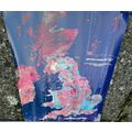


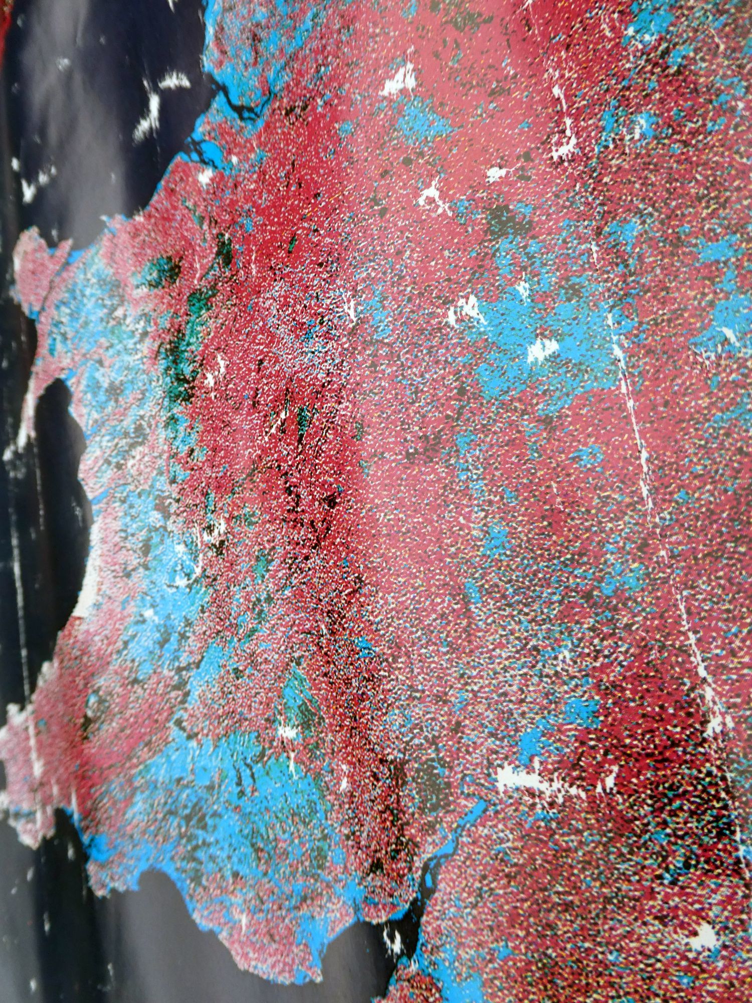
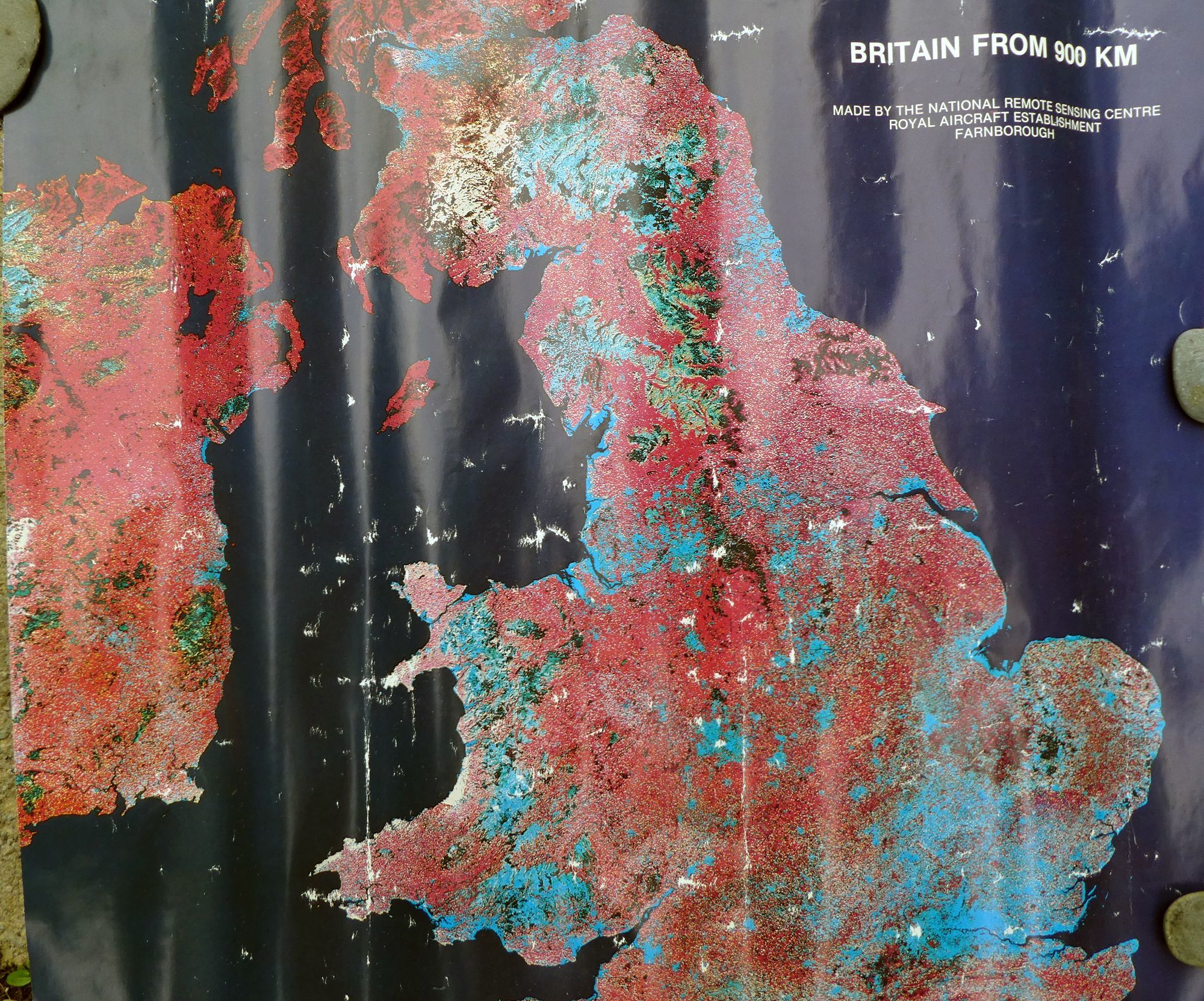


Britain from 500 km - Landsat Mosaic - 1980's
The seller has placed a "Holiday Notice" on this listing.
BuyNow is currently not available. The notice can be read just below.
BuyNow is currently not available. The notice can be read just below.
£0.55
Important Holiday Notice from Seller : I'm away. Back on 30th July. Please enjoy browsing my shop in the mean time when service will return to normal.
- Condition : Used
- Dispatch : Next Day
- Brand : None
- ID# : 185721350
- Quantity : 1 item
- Views : 2721
- Location : United Kingdom

- Seller : dracogalaxy (+15)
- Barcode : None
- Start : Wed 02 Oct 2019 23:54:50 (BST)
- Close : Run Until Sold
- Remain : Run Until Sold
 for 1 item(s)


Seller's Description
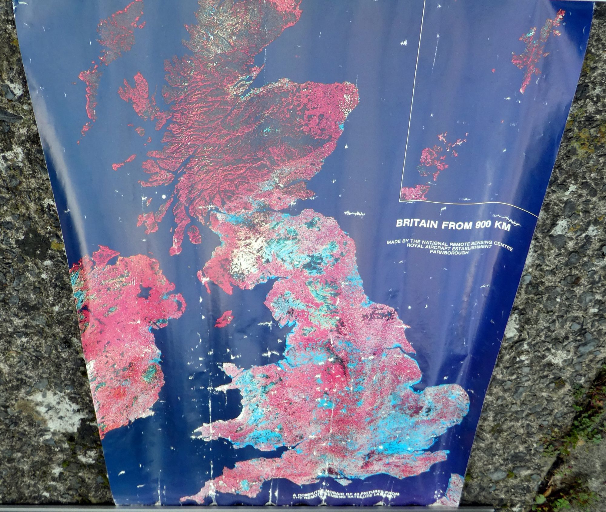
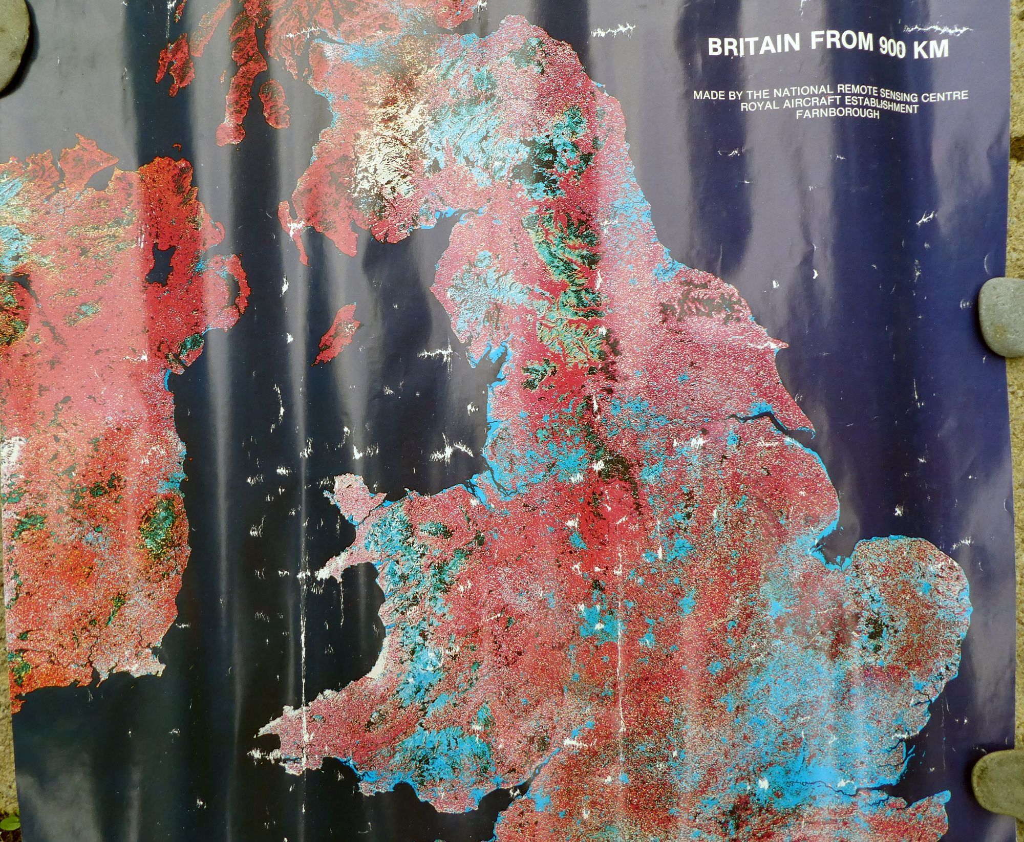
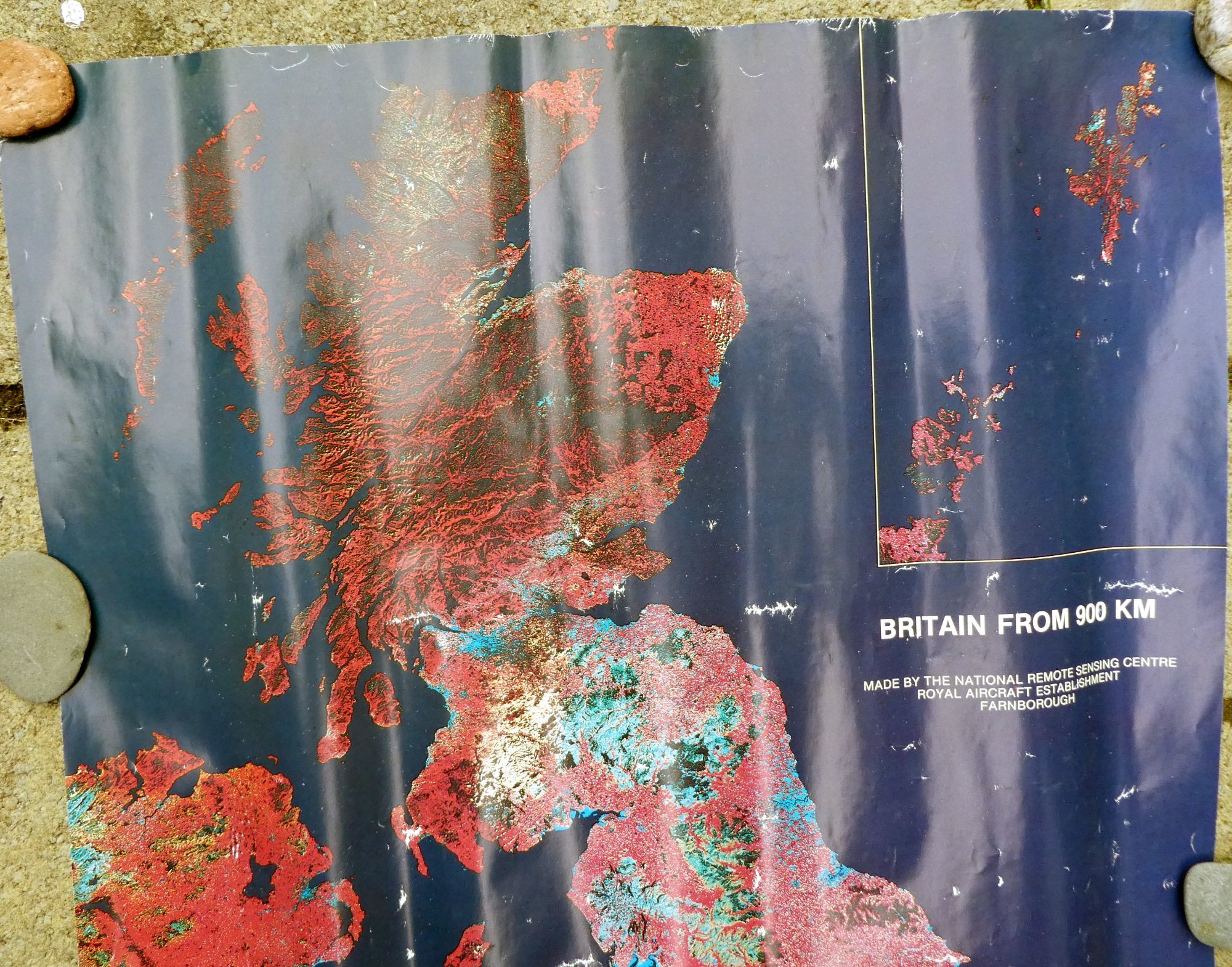
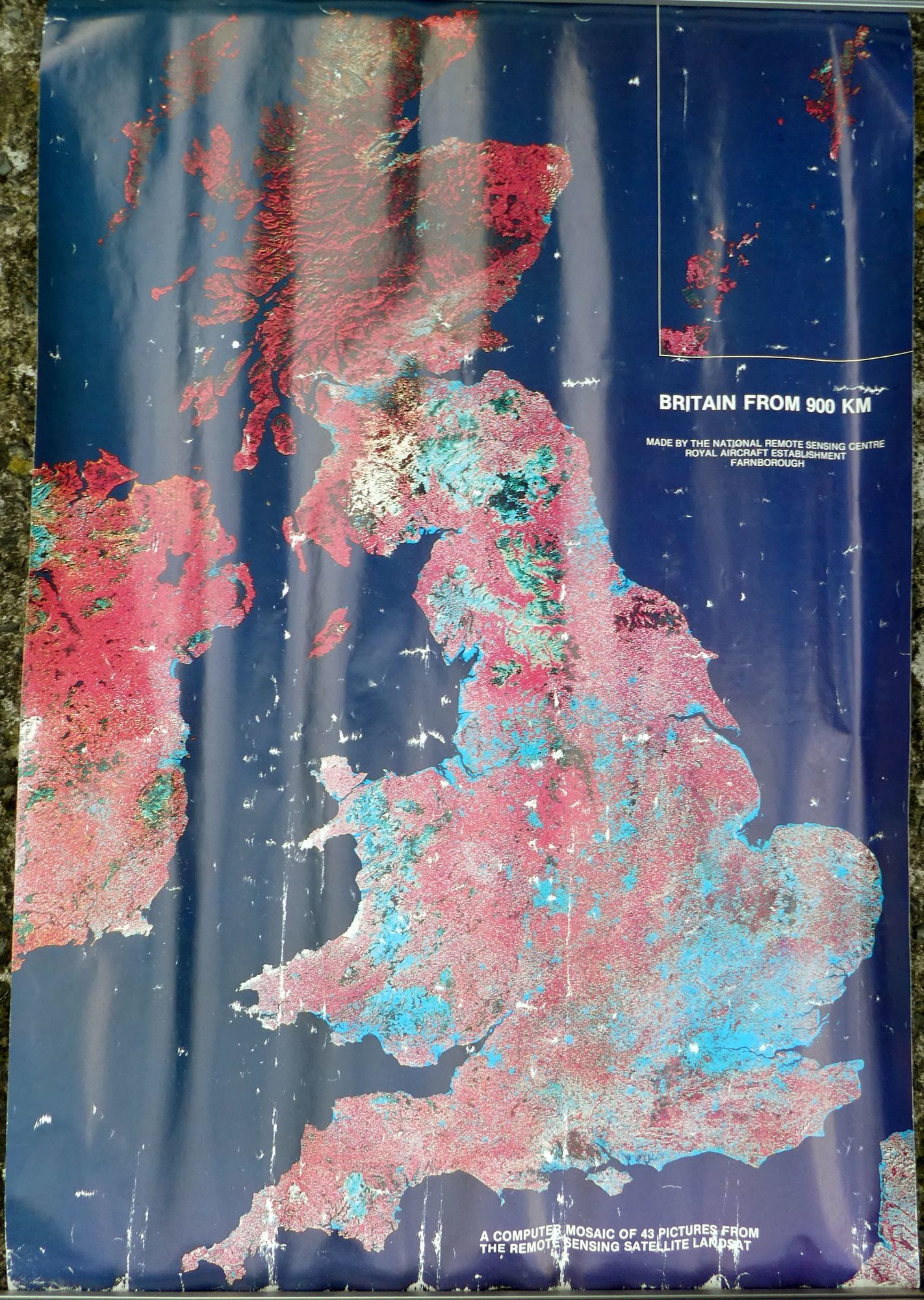
Britain from 500 km
- Era: Sometime from 1980 to 1986
- Made by the National Remote Sensing Centre, Royal Aircraft Establishment, Farnborough
- A Computer Mosaic of 43 Pictures from the remote Sensing Satellite Landsat
- Size: 71cm tall x 47cm wide
- Weight: 48g
- Condition: Very heavily used as it has been stuck on several walls over the years, rolled up in one direction, rolled up in another direction and some of the poster material has come off as there are little white blotches. As you can see from the images – it could probably do with being behind a glass picture frame to flatten it out.
- General Comments: This was one of the earliest publicly released posters of the UK. Landsat was a series of NASA Earth mapping missions with a resolution of about 100m. The mosaic was made from 43 individual images, and combined so as to remove cloud cover. It is a false colour image – the red is really infrared light and shows where the vegetation lies in the UK. Turquoise Blue are built up areas or if in river estuaries or on the sea are muddy areas. The brown areas are probably forests. In northern England/South Scotland we either see cloud cover, frost or snow. Why would anyone be interested in a damaged map like this? Mostly because it was one of the first publicly released satellite mosaics of the UK to illustrate the power of Remote Sensing & more importantly is rare to find on eBid or . Alternatively, you are welcome to buy this and cut it up for making a collage or art work. The price being sold at reflects the condition of the poster - though the Royal Mail Postage is the main cost here as they only accept posters of this size as Medium parcels.
Enjoy!
Listing Information
| Listing Type | Gallery Listing |
| Listing ID# | 185721350 |
| Start Time | Wed 02 Oct 2019 23:54:50 (BST) |
| Close Time | Run Until Sold |
| Starting Bid | Fixed Price (no bidding) |
| Item Condition | Used |
| Bids | 0 |
| Views | 2721 |
| Dispatch Time | Next Day |
| Quantity | 1 |
| Location | United Kingdom |
| Auto Extend | No |
Seller Recent Feedback
Returns Policy
Returns Accepted
Returns not acceptable after 30 days of purchase. Buyer pays for packaging and postage.