Bembridge, Isle of Wight - 1836 print on postcard
- Condition : Used
- Dispatch : 2 Days
- Brand : None
- ID# : 128323316
- Quantity : 1 item
- Views : 1144
- Location : United Kingdom

- Seller : justthebook (+1699)
- Barcode : None
- Start : Mon 19 May 2014 20:16:20 (BST)
- Close : Run Until Sold
- Remain : Run Until Sold
 for 1 item(s)
More Listings from This Seller view all


Seller's Description
- Postcard
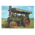
- Picture / Image: Bembridge, Isle of Wight, 1836
- Publisher: Isle of Wight County Press
- Postally used: no
- Stamp: n/a
- Postmark(s): n/a
- Sent to: n/a
- Notes / condition:
Please ask if you need any other information and I will do the best I can to answer.
Image may be low res for illustrative purposes - if you need a higher definition image then please contact me and I may be able to send one.
------------------------------------------------
Postage & Packing:
UK (incl. IOM, CI & BFPO): 99p
Europe: £1.60
Rest of world (inc. USA etc): £2.75
No additional charges for more than one postcard. You can buy as many postcards from me as you like and you will just pay the fee above once. (If buying postcards with other things such as books, please contact or wait for invoice before paying).
Payment Methods:
UK - PayPal, Cheque (from UK bank) or postal order
Outside UK: PayPal ONLY (unless otherwise stated) please. NO non-UK currency checks or money orders (sorry).
NOTE: All postcards are sent in brand new stiffened envelopes which I have bought for the task. These are specially made to protect postcards and you may be able to re-use them. In addition there are other costs to sending so the above charge is not just for the stamp!
I will give a full refund if you are not fully satisfied with the postcard.
----------------------------------------------
Text from the free encyclopedia WIKIPEDIA may appear below to give a little background information (internal links may not work) :
*************
Bembridge is a village and civil parish[1][dead link] located on the easternmost point of the Isle of Wight. It had a population of 3,848 according to the 2001 census of the United Kingdom,[2] leading to claims by residents that Bembridge is the largest village in England,[3] and occasional claims that it is the largest village in Europe. Bembridge is home to many of the Island's wealthiest residents.
Bembridge sits at the extreme eastern point of the Isle of Wight. Prior to land reclamation the area of Bembridge and Yaverland was almost an island unto itself, separated from the remainder of the Isle of Wight by Brading Haven. Prior to the Victorian era Bembridge was a collection of wooden huts and farmhouses, which only consolidated into a true village with the building of the church in 1827 (later rebuilt in 1846). The historical heart of the village is located close to the church in the north of the village, consisting of a number of shops, pubs and restaurants, along with the Village Hall and site of the former Parish Council hall. Bembridge Library serves the community and there is a local museum in the same location.
The Lane End district is located to the South of the village. It is largely composed of modern bungalows and a small shopping area which includes a Co-Op store. The lane comes to an end at the beach, where Bembridge Lifeboat station and the Bembridge Coast Hotel are situated. Formerly many of the bungalows were on the land of a cottage where Cecily Cardew lived,[citation needed] after whom an Oscar Wilde character was named. Moving inland from Lane End one finds Bembridge Primary school, along with the local community centre, which are connected by a large recreational playing field.
Bembridge is a local service centre, hosting Bembridge Primary School (see Education on the Isle of Wight for more information on the use of this term), a post office, several shops located in two main areas, and Methodist, Anglican and Catholic churches. It is also the location of a local fire station, (crewed by a team of retained firemen), and a Royal National Lifeboat Institution (RNLI) lifeboat station.[4]
Bembridge Airport is a local airport with a concrete runway, and is located close to the Windmill to the west of the village proper heading towards Yaverland.
The war memorial was designed by local architect, Percy Stone (1856–1934).[5]
The RNLI station is particularly significant, as it extends into the sea to the east of the village. Here lies the notorious ""Bembridge Ledge"", a large, rocky outcrop which poses a major threat to passing boats.[6] Although it is private sailing yachts which are most at risk, a wide variety of boats commonly run aground here, especially in the often stormy weather conditions which affect the Solent during winter months. A former Bembridge lifeboat, the RNLB Jesse Lumb, is part of the National Historic Fleet, Core Collection, and exhibited at Imperial War Museum Duxford.[7]
The current offshore boathouse was completed in Autumn 2010 by BAM Nuttall and Ecochoice and houses a new Tamar class boat, the 'Alfred Albert Williams'.[8] The Inshore lifeboat station is currently being rebuilt. A complete new concrete walkway was built, and the new station is made completely of naturally durable timber.
Close to the lifeboat station lies a coastguard lookout. Positioned at a high elevation, this offers views of the Solent meeting the English Channel to the east of the Isle of Wight. From this vantage point one is able to view a variety of watercraft year round, although there is more marine traffic in the summer..
type=printed postcards
theme=topographical: british
sub-theme=england
county/ country=isle of wight
number of items=single
period=1945 - present
postage condition=unposted
Listing Information
| Listing Type | Gallery Listing |
| Listing ID# | 128323316 |
| Start Time | Mon 19 May 2014 20:16:20 (BST) |
| Close Time | Run Until Sold |
| Starting Bid | Fixed Price (no bidding) |
| Item Condition | Used |
| Bids | 0 |
| Views | 1144 |
| Dispatch Time | 2 Days |
| Quantity | 1 |
| Location | United Kingdom |
| Auto Extend | No |