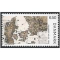
A map of the vicinity of the city of Warsaw drawn up for maneuvers in 1838. In R
- Zustand : Gebraucht
- Versand : Am selben Tag
- Marke : Keine
- ID# : 223984745
- Menge : 1 Artikel
- Besucherzahl : 54
- Ort : USA

- Verkäufer : FoliBiblio (0)
- Barcode : Keine
- Beginn : Mi 02 Okt 2024 17:29:23 (CEST)
- Ende : Läuft-bis-verkauft
- Verbleibend : Läuft-bis-verkauft
 von 1 Artikel(n)
 Weiteres von diesem Verkäufer Alle anzeigen


Beschreibung (Anbieter)
A map of the vicinity of the city of Warsaw drawn up for maneuvers in 1838. In Russian (ask us if in doubt)/Karta okrestnostey goroda Varshavy sostavlennaya dlya manevrov 1838 godu. On a scale of 2 miles In English In ch., 1838, 1 sheet, case, engraved card on fabric basis with hand-paIn ted watercolor. Map size (with fields) 54x46 cm,. We have thousands of titles and often several copies of each title may be available. Please feel free to contact us for a detailed description of the copies available. SKUalbcfd61b08753cd11a.
Ausschreibungsinformation
| Ausschreibungsart | Galerie-Ausschreibung |
| Ausschreibung Nr. | 223984745 |
| Startzeit | Mi 02 Okt 2024 17:29:23 (CEST) |
| Endzeit | Läuft-bis-verkauft |
| Startgebot | Festpreis (Bieten nicht möglich) |
| Artikelzustand | Gebraucht |
| Gebote | 0 |
| Besucherzahl | 54 |
| Versandzeit | Am selben Tag |
| Menge | 1 |
| Ort | USA |
| Automatisch verlängern | Nein |
Neueste Verkäuferbewertungen
Rückgabebestimmungen
Rücksendung akzeptiert