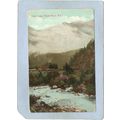
Portland Bill, Weymouth, Dorset - ES postcard c.1910
- Condition : Used
- Dispatch : 2 Days
- Brand : None
- ID# : 93649015
- Quantity : 1 item
- Views : 588
- Location : United Kingdom

- Seller : justthebook (+1703)
- Barcode : None
- Start : Sat 23 Feb 2013 15:55:51 (EDT)
- Close : Run Until Sold
- Remain : Run Until Sold
Checks/Cheques
 for 1 item(s) edit
Shipping Calculator
More Listings from This Seller view all


Seller's Description
- Postcard
- Picture / Image: Portland Bill, Weymouth, Dorset
- Publisher: ES, London (No. 552)
- Postally used: no
- Stamp: n/a
- Postmark(s): n/a
- Sent to: n/a
- Notes / condition: slight wear
Please ask if you need any other information and I will do the best I can to answer.
------------------------------------------------
Postage & Packing:
UK (incl. IOM, CI & BFPO): 99p
Europe: £1.60
Rest of world (inc. USA etc): £2.75
No additional charges for more than one postcard. You can buy as many postcards from me as you like and you will just pay the fee above once. (If buying postcards with other things such as books, please contact or wait for invoice before paying).
Payment Methods:
UK - PayPal, Cheque (from UK bank) or postal order
Outside UK: PayPal ONLY (unless otherwise stated) please. NO non-UK currency checks or money orders (sorry).
NOTE: All postcards are sent in brand new stiffened envelopes which I have bought for the task. These are specially made to protect postcards and you may be able to re-use them. In addition there are other costs to sending so the above charge is not just for the stamp!
I will give a full refund if you are not fully satisfied with the postcard.
----------------------------------------------
Text from the free encyclopedia WIKIPEDIA may appear below to give a little background information (internal links may not work) :
*************
Portland Bill is a narrow promontory (or bill) of Portland stone, which forms the most southerly part of Isle of Portland, and therefore also the county of Dorset, England. One of Portland's most popular destinations, the popular attraction Portland Bill Lighthouse is found in the area, whilst Portland Bill is also noted for its rough coast.
The area of Portland Bill was once used for quarrying until the early years of the 20th century. The Portland Bill Lighthouse was built with stone from these quarries and the area was then finally abandoned. Even today, evidence of quarrying tramways can be found. In the storms of January 1990, the weather ripped out an area of cliff top to reveal old rails from the Victorian tramway where it curved round to meet Portland Bill's crane.
Portland had no road reaching to Portland Bill until one was built between the World Wars and visitors originally had to travel over a rough track. A small number of housing is found in the area, largely around the Old Lower Lighthouse, and the housing remains one of the most remote settlements in South Dorset.
The Ministry of Defence Magnetic Range is found at Portland Bill, where tests can be performed away from stray electric and magnetic fields. Close to this range is Portland's ""Raised Beach"" - created during a warm inter-glacial climate change 200,000 years ago when sea levels were about 15 metres above present levels.[1] A Coastguard station is also located close to Portland Bill.[2]
During the total total eclipse of the sun in August 1999, the eclipse passed one kilometre off Portland Bill, where thousands of people travelled to the area for the experience.[3]
Many beach huts are found in the Portland Bill area, and often sell for prices around £30,000.[4] This is due to the modern planning regulations which were not in force when the huts were originally placed at Portland Bill.[5]
The Bill is an important way-point for coastal traffic, and so three lighthouses have been built to protect shipping, in particular from its strong tidal race and shallow reef. Both Portland Bill and Chesil Beach are the location of many sunken vessels that failed to reach Weymouth or Portland Roads. The ""Portland Race"" is caused by the meeting of the tides between the Bill and the Shambles sandbank about 3 miles south-east, and strong currents often break the sea so fiercely that from the shore a continuous disturbance can be seen. The lighthouse's guided vessels heading for Portland and Weymouth through these hazardous waters as well as acting as a waymark for ships navigating the English Channel.[6] The Bill's three lighthouses are the only built on the island, except for the Portland Breakwater Lighthouse, located at Portland Harbour.
The most recent lighthouse is the distinctively white and red striped Portland Bill Lighthouse, which was built in 1906 and is 35 metres (115 ft) high. A popular tourist attraction, tours of the lighthouse are operated by Trinity House, whilst a visitor centre/gift shop is also open during peak season. Due to the construction of the lighthouse, both other lighthouses became disused. The Old Lower Lighthouse became a bird observatory whilst the Old Higher Lighthouse became the home of Marie Stopes, and today remains a holiday let.
type=printed postcards
theme=topographical: british
sub-theme=england
county/ country=dorset
number of items=single
period=1945 - present
postage condition=unposted
Listing Information
| Listing Type | Gallery Listing |
| Listing ID# | 93649015 |
| Start Time | Sat 23 Feb 2013 15:55:51 (EDT) |
| Close Time | Run Until Sold |
| Starting Bid | Fixed Price (no bidding) |
| Item Condition | Used |
| Bids | 0 |
| Views | 588 |
| Dispatch Time | 2 Days |
| Quantity | 1 |
| Location | United Kingdom |
| Auto Extend | No |