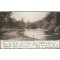
Map - Texas - John Hinde postcard 1980s
- Condition : Used
- Dispatch : 2 Days
- Brand : None
- ID# : 93647601
- Quantity : 1 item
- Views : 337
- Location : United Kingdom

- Seller : justthebook (+1699)
- Barcode : None
- Start : Sat 23 Feb 2013 15:41:42 (EDT)
- Close : Run Until Sold
- Remain : Run Until Sold
Checks/Cheques
 for 1 item(s) edit
Shipping Calculator
More Listings from This Seller view all


Seller's Description
- Postcard
- Picture / Image: Map - Texas - 'The Biggest and Best'
- Publisher: John Hinde Curteich
- Postally used: no
- Stamp: n/a
- Postmark(s): n/a
- Sent to: n/a
- Notes / condition: small label and label mark on back
Check out my !
Please ask if you need any other information and I will do the best I can to answer.
------------------------------------------------
Postage & Packing:
UK (incl. IOM, CI & BFPO): 99p
Europe: £1.60
Rest of world (inc. USA etc): £2.75
No additional charges for more than one postcard. You can buy as many postcards from me as you like and you will just pay the fee above once. (If buying postcards with other things such as books, please contact or wait for invoice before paying).
Payment Methods:
UK - PayPal, Cheque (from UK bank) or postal order
Outside UK: PayPal ONLY (unless otherwise stated) please. NO non-UK currency checks or money orders (sorry).
NOTE: All postcards are sent in brand new stiffened envelopes which I have bought for the task. These are specially made to protect postcards and you may be able to re-use them. In addition there are other costs to sending so the above charge is not just for the stamp!
I will give a full refund if you are not fully satisfied with the postcard.
----------------------------------------------
Text from the free encyclopedia WIKIPEDIA may appear below to give a little background information (internal links may not work) :
*************
Texas is the second most populous and the second-largest of the 50 states in the United States of America, and the largest state in the 48 contiguous United States. Located in the South Central United States, Texas shares an international border with the Mexican states of Chihuahua, Coahuila, Nuevo León and Tamaulipas to the south, and borders the U.S. states of New Mexico to the west, Oklahoma to the north, Arkansas to the northeast and Louisiana to the east. Texas has an area of 268,820 square miles (696,200 km2), and a growing population of 25.7 million residents.[9]
Houston is the largest city in Texas and the fourth-largest in the United States, while San Antonio is the second largest in the state and seventh largest in the United States. Dallas–Fort Worth and Greater Houston are the fourth and fifth largest United States metropolitan areas, respectively. Other major cities include El Paso and Austin—the state capital. Texas is nicknamed the Lone Star State to signify Texas as a former independent republic and as a reminder of the state's struggle for independence from Mexico. The ""Lone Star"" can be found on the Texas state flag and on the Texas state seal today.[10]
Due to its size and geologic features such as the Balcones Fault, Texas contains diverse landscapes that resemble both the American South and Southwest.[11] Although Texas is popularly associated with the Southwestern deserts, less than 10% of the land area is desert.[12] Most of the population centers are located in areas of former prairies, grasslands, forests, and the coastline. Traveling from east to west, one can observe terrain that ranges from coastal swamps and piney woods, to rolling plains and rugged hills, and finally the desert and mountains of the Big Bend.
The term ""six flags over Texas"" came from the several nations that had ruled over the territory. Spain was the first European country to claim the area of Texas. France held a short-lived colony in Texas. Mexico controlled the territory until 1836 when Texas won its independence, becoming an independent Republic. In 1845 it joined the United States as the 28th state. The state's annexation set off a chain of events that caused the Mexican–American War in 1846. A slave state, Texas declared its secession from the United States in early 1861, joining the Confederate States of America during the American Civil War. After the war and its restoration to the Union, Texas entered a long period of economic stagnation.
One Texas industry that thrived after the Civil War was cattle. Due to its long history as a center of the industry, Texas is associated with the image of the cowboy. The state's economic fortunes changed in the early 20th century, when oil discoveries initiated an economic boom in the state. With strong investments in universities, Texas developed a diversified economy and high tech industry in the mid-20th century. As of 2010 it shares the top of the list of the most Fortune 500 companies with California at 57.[13] With a growing base of industry, the state leads in many industries, including agriculture, petrochemicals, energy, computers and electronics, aerospace, and biomedical sciences. Texas has led the nation in export revenue since 2002 and has the second-highest gross state product.
type=printed postcards
theme=topographical: rest of the world
sub-theme=north america
county/ country=united states
number of items=single
period=1945 - present
postage condition=unposted
Listing Information
| Listing Type | Gallery Listing |
| Listing ID# | 93647601 |
| Start Time | Sat 23 Feb 2013 15:41:42 (EDT) |
| Close Time | Run Until Sold |
| Starting Bid | Fixed Price (no bidding) |
| Item Condition | Used |
| Bids | 0 |
| Views | 337 |
| Dispatch Time | 2 Days |
| Quantity | 1 |
| Location | United Kingdom |
| Auto Extend | No |
Seller Recent Feedback
Returns Policy
Purchase Activity
Questions and Answers
|
Question From sarah1014 [+1] Sun 03 May 2015 03:07:35 (EDT) Are you still active? continental
size?
|
Answer From justthebook [+1699] Sun 03 May 2015 12:52:03 (EDT) Hi - yes I am still active!
This card actually the (old)
standard size not
continental. (Did you get my
reply to the question about
the Swedish postcard
?). Best wishes, Tony.
|