Free Shipping
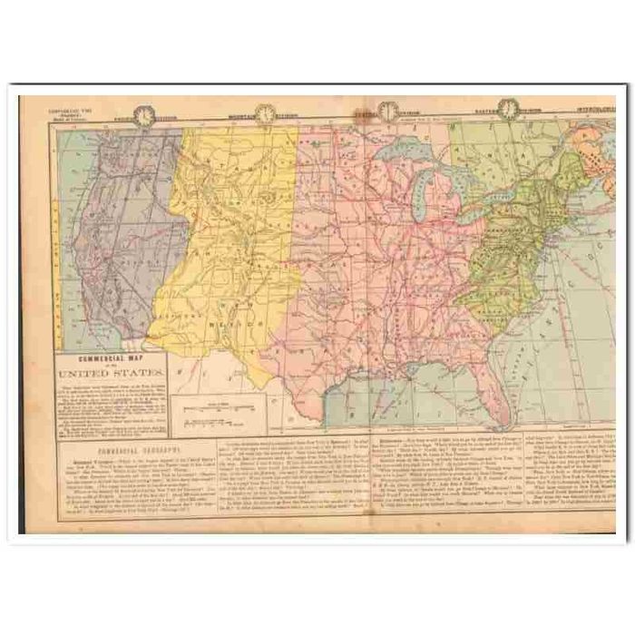

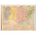
commercial vintage map of the united states 1882
- Condition : Used
- Dispatch : 2 Days
- Brand : None
- ID# : 172563526
- Quantity : 1 item
- Views : 552
- Location : United States

- Seller : Silveriver (+2904)
- Barcode : None
- Start : Fri 13 Jul 2018 18:24:05 (EDT)
- Close : Run Until Sold
- Remain : Run Until Sold
 for 1 item(s)
More Listings from This Seller view all


Seller's Description
Original vintage COMMERCIAL MAP OF THE UNITED STATES. The double page measures 18.25 x 12 inches, and the image size measuring 17 x 8.75 inches. Printed by A.S. Barnes and Company of NY and Chicago. The Red Stars show center of population of U.S. every ten years from 1790 (E. of Baltimore) to 1880 (S.W. of Cincinnati). Red Lines on the water show routes of steamers; those on the land, the most important railroads. Red Lines on the ocean show also the cables (submarine telegraph lines) to Europe. The Steamer Routes show distance made each day, etc. Every red dot represents one hour. The Railroad show distances made by trains each day, etc. For this purpose Chicago and New York are taken as leading centers or starting points. Old 1882 antique map would look sensational matted and framed.
Listing Information
| Listing Type | Gallery Listing |
| Listing ID# | 172563526 |
| Start Time | Fri 13 Jul 2018 18:24:05 (EDT) |
| Close Time | Run Until Sold |
| Starting Bid | Fixed Price (no bidding) |
| Item Condition | Used |
| Bids | 0 |
| Views | 552 |
| Dispatch Time | 2 Days |
| Quantity | 1 |
| Location | United States |
| Auto Extend | No |
Seller Recent Feedback
Returns Policy
Returns Not Accepted