Castle Douglas, Dumfries & Galloway - swans, boating on Carlingwark Loch - 1984
- Condition : Used
- Dispatch : 2 Days
- Brand : None
- ID# : 180559755
- Quantity : 1 item
- Views : 362
- Location : United Kingdom

- Seller : justthebook (+1703)
- Barcode : None
- Start : Tue 07 May 2019 19:29:40 (EDT)
- Close : Run Until Sold
- Remain : Run Until Sold
Checks/Cheques
 for 1 item(s) edit
Shipping Calculator
More Listings from This Seller view all
Seller's Description
- Postcard
- Picture / Image: Castle Douglas, Dumfries & Galloway - swans near the boating corner on Carlingwark Loch
- Publisher: Whiteholme 'Hail Caledonia' (5112 W)
- Postally used: yes
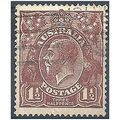
- Stamp: 12&half light green Machin
- Postmark(s): Dumfries 1984
- Sent to: Boston, Lincs.
- Notes / condition:
Please ask if you need any other information and I will do the best I can to answer.
------------------------------------------------
Postage and packing charge should be showing for your location (contact if not sure).
UK - PayPal, Cheque (from UK bank) or postal order
I will give a full refund if you are not fully satisfied with the postcard.
----------------------------------------------
Castle Douglas (Gd: Caisteal Dhùghlais), a town in the south of Scotland in Dumfries and Galloway, lies in the eastern part of Galloway known as the Stewartry, between the towns of Dalbeattie and Gatehouse of Fleet.
Castle Douglas is built next to Carlingwark Loch in which traces of prehistoric crannogs can be found, evidence of early inhabitation of the area. To the North of the town Glenlochar is the site of two successive Roman forts, the first being erected during the invasion of Agricola and the second during the Antonine period. They appear to have been for cavalry units and evidence has been found that a "vicus" grew up around them. They were abandoned completely about 160.[1]
Nearby Threave Castle was a seat of the powerful "Black" Earls of Douglas. A small collection of cottages developed by the shores of Carlingwark, which was a source of marl. These cottages can still be seen on the Western approach to Castle Douglas and are known as The Buchan. The development of a military road through Galloway, built by General Wade after Jacobite rising of 1745, passed through the Carlingwark area and improved transportation connections in the 18th century.
Castle Douglas was founded in 1792 by a wealthy descendant of the Douglas family, William Douglas, who made his money in an 'American Trade' and created a planned town on the shores of Carlingwark Loch. The town's layout is based upon the grid plan pattern of streets as used in Edinburgh's New Town, built around the same time. Sir William Douglas also created a number of industries in Castle Douglas, including hand-woven cotton factories from which Cotton Street derives its name.
The completion of the Castle Douglas and Dumfries Railway in 1859 further improved the town's connections, and it soon developed into a major market town for the surrounding area. This is still true today and the 1900 hexagonal market building is in constant use. Although the railway was closed in 1965, the A75 trunk road was developed roughly following the lines of the original military road and passes through Castle Douglas. The many hotels and pubs which derived from coach stops are an indication of the town's importance as a stopping place for travellers.
Castle Douglas was a reception area for Glasgow's evacuated children during World War II. From March 1943 to April 1944, the town was the base for 92nd (Loyals) Light Anti-Aircraft Regiment, Royal Artillery, which was training for Operation Overlord, the invasion of occupied Europe.
Carlingwark Loch is a small loch in Dumfries and Galloway, Scotland lying just south of Castle Douglas and is roughly rectangular in shape, trending nearly north and south. The name of the loch comes from the Scots Gaelic word Caer meaning fort and wark the old Scots language word for work.[3] There are four artificial islets in the loch showing evidence of fortification and settlement, Ash Island is thought to be a crannog. Several archaeological finds have been retrieved from the loch including a bronze cauldron, sword and pan and two dugout canoes.[4]
There is a 5.25 km (3.26 mi) footpath around the loch and it is popular for bird watching and fishing. As of 5 March 2012 the loch and the land around it has been designated as a Scottish Site of Special Scientific Interest on account of its varied birdlife and grassland.[5]
In 1903 the loch was surveyed[2] by E.R. Watson and later charted [6] as part of The Bathymetrical Survey of Fresh-Water Lochs of Scotland 1897-1909.[7]
In 2009 an aerating fountain was installed at a cost of £10,000 to try to prevent the build-up of blue-green algae. The funding was provided by South West Scotland Environmental Action Trust.[8] The installation of the fountain was part of a wider development of Carlingwark Outdoor Activity Centre by Dumfries and Galloway Council.[9]
Listing Information
| Listing Type | Gallery Listing |
| Listing ID# | 180559755 |
| Start Time | Tue 07 May 2019 19:29:40 (EDT) |
| Close Time | Run Until Sold |
| Starting Bid | Fixed Price (no bidding) |
| Item Condition | Used |
| Bids | 0 |
| Views | 362 |
| Dispatch Time | 2 Days |
| Quantity | 1 |
| Location | United Kingdom |
| Auto Extend | No |


