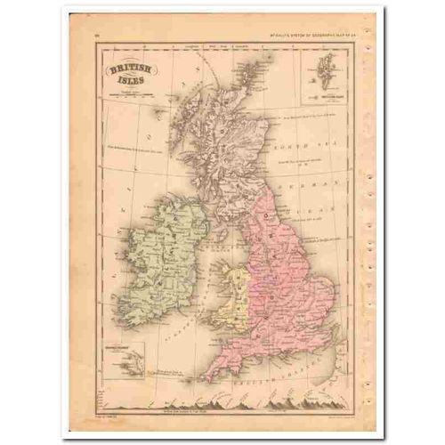
british isles 1882 england wales ireland scotland antique vintage map
- Condition : Used
- Dispatch : 2 Days
- Brand : None
- ID# : 172563545
- Quantity : 1 item
- Views : 3577
- Location : United States

- Seller : Silveriver (+2904)
- Barcode : None
- Start : Fri 13 Jul 2018 18:24:05 (EDT)
- Close : Run Until Sold
- Remain : Run Until Sold
More Listings from This Seller view all
Seller's Description
Vintage original 1882 Map of the BRITISH ISLES. Beautifully detailed of England, Wales, Ireland and Scotland. Has insets of The Channel Islands and The Shetland Isles in the upper right corner. This hand colored, steel engraved map was drawn by J. Wells of N.Y. and was engraved by Oliver J. Stewart of N.Y. Printed by A.S. Barnes and Company of NY and Chicago. This 127+ year old map would look sensational matted and framed! A true antique.
Listing Information
| Listing Type | Gallery Listing |
| Listing ID# | 172563545 |
| Start Time | Fri 13 Jul 2018 18:24:05 (EDT) |
| Close Time | Run Until Sold |
| Starting Bid | Fixed Price (no bidding) |
| Item Condition | Used |
| Bids | 0 |
| Views | 3577 |
| Dispatch Time | 2 Days |
| Quantity | 1 |
| Location | United States |
| Auto Extend | No |
Seller Recent Feedback
Returns Policy
Returns Not Accepted


 for 1 item(s)


