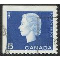
Achill Island, Co. Mayo - Cliffs of Minaun, Keel Bay & village - Cardall c.1960s
- Condition : Used
- Dispatch : 2 Days
- Brand : None
- ID# : 182471465
- Quantity : 1 item
- Views : 453
- Location : United Kingdom

- Seller : justthebook (+1703)
- Barcode : None
- Start : Sun 09 Jun 2019 05:20:51 (EDT)
- Close : Run Until Sold
- Remain : Run Until Sold
Checks/Cheques
 for 1 item(s) edit
Shipping Calculator
More Listings from This Seller view all


Seller's Description
- Postcard
- Picture / Image: The Cliffs of Minaun, Keel Bay and Keel village, Achill Island, Co. Mayo, Ireland
- Publisher: Cardall Ltd., Dublin
- Postally used: no
- Stamp: n/a
- Postmark(s): n/a
- Sent to: n/a
- Notes / condition: small line near top
Please ask if you need any other information and I will do the best I can to answer.
Image may be low res for illustrative purposes - if you need a higher definition image then please contact me and I may be able to send one. No cards have been trimmed (unless stated).
------------------------------------------------
Postage & Packing:
Postage and packing charge should be showing for your location (contact if not sure).
No additional charges for more than one postcard. You can buy as many postcards from me as you like and you will just pay the fee above once. Please wait for combined invoice. (If buying postcards with other things such as books, please contact or wait for invoice before paying).
Payment Methods:
UK - PayPal, Cheque (from UK bank) or postal order
Outside UK: PayPal ONLY (unless otherwise stated) please. NO non-UK currency checks or money orders (sorry).
NOTE: All postcards are sent in brand new stiffened envelopes which I have bought for the task. These are specially made to protect postcards and you may be able to re-use them. In addition there are other costs to sending so the above charge is not just for the stamp!
I will give a full refund if you are not fully satisfied with the postcard.
----------------------------------------------
Text from the free encyclopedia WIKIPEDIA may appear below to give a little background information (internal links may not work) :
*************
Achill Island (/ˈækəl/; Irish: Acaill, Oileán Acla) in County Mayo is the largest island off the coast of Ireland, and is situated off the west coast. It has a population of 2,700. Its area is 148 km2(57 sq mi). Achill is attached to the mainland by Michael Davitt Bridge, between the villages of Gob an Choire (Achill Sound) and Poll Raithní (Polranny). A bridge was first completed here in 1887, replaced by another structure in 1949, and subsequently replaced with the current bridge which was completed in 2008. Other centres of population include the villages of Keel, Dooagh, Dumha Éige (Dooega), Dooniver, The Valley and Dugort. The parish's main Gaelic football pitch and two secondary schools are on the mainland at Poll Raithní. Early human settlements are believed to have been established on Achill around 3000 BC. A paddle dating from this period was found at the crannóg near Dookinella. The island is 87% peat bog. The parish of Achill also includes the Curraun peninsula. Some of the people of Curraun consider themselves Achill people, and most natives of Achill refer to this area as being "in Achill". There are between 500-600 native Irish speakers in Achill parish. In the summer of 1996, the RNLI decided to station a lifeboat at Kildownet.
Despite some development, the island retains a striking natural beauty. The cliffs of Croaghaun on the western end of the island are the third highest sea cliffs in Europe but are inaccessible by road. Near the westernmost point of Achill, Achill Head, is Keem Bay. Keel Beach is quite popular with tourists and some locals as a surfing location. South of Keem beach is Moytoge Head, which with its rounded appearance drops dramatically down to the ocean. An old British observation post, built during World War I to prevent the Germans from landing arms for the Irish Republican Army, is still standing on Moytoge. During the Second World War this post was rebuilt by the Irish Defence Forces as a Look Out Post for the Coast Watching Service wing of the Defence Forces. It operated from 1939 to 1945.[7]
The mountain Slievemore (672 m) rises dramatically in the north of the island and the Atlantic Drive (along the south/west of the island) has some dramatically beautiful views. On the slopes of Slievemore, there is an abandoned village (the "Deserted Village") The Deserted Village is traditionally thought to be a remnant village from An Gorta Mór (The Great Hunger of 1845-1849).
Just west of the deserted village is an old Martello tower, again built by the British to warn of any possible French invasion during the Napoleonic Wars. The area also boasts an approximately 5000-year-old Neolithic tomb.
Achillbeg (Acaill Beag, Little Achill) is a small island just off Achill's southern tip. Its inhabitants were resettled on Achill in the 1960s.[8] A plaque to Johnny Kilbane is situated on Achillbegand was erected to celebrate 100 years since his first championship win.[9]
The villages of Dooniver and Askill have very picturesque scenery and the cycle route is popular with tourists.
Listing Information
| Listing Type | Gallery Listing |
| Listing ID# | 182471465 |
| Start Time | Sun 09 Jun 2019 05:20:51 (EDT) |
| Close Time | Run Until Sold |
| Starting Bid | Fixed Price (no bidding) |
| Item Condition | Used |
| Bids | 0 |
| Views | 453 |
| Dispatch Time | 2 Days |
| Quantity | 1 |
| Location | United Kingdom |
| Auto Extend | No |