

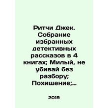
A map of the vicinity of the city of Warsaw drawn up for maneuvers in 1838. In R
- Condition : Used
- Dispatch : Same Day
- Brand : None
- ID# : 223984745
- Quantity : 1 item
- Views : 35
- Location : United States

- Seller : FoliBiblio (0)
- Barcode : None
- Start : Wed 02 Oct 2024 11:29:23 (EDT)
- Close : Run Until Sold
- Remain : Run Until Sold
 for 1 item(s)
More Listings from This Seller view all


Seller's Description
A map of the vicinity of the city of Warsaw drawn up for maneuvers in 1838. In Russian (ask us if in doubt)/Karta okrestnostey goroda Varshavy sostavlennaya dlya manevrov 1838 godu. On a scale of 2 miles In English In ch., 1838, 1 sheet, case, engraved card on fabric basis with hand-paIn ted watercolor. Map size (with fields) 54x46 cm,. We have thousands of titles and often several copies of each title may be available. Please feel free to contact us for a detailed description of the copies available. SKUalbcfd61b08753cd11a.
Listing Information
| Listing Type | Gallery Listing |
| Listing ID# | 223984745 |
| Start Time | Wed 02 Oct 2024 11:29:23 (EDT) |
| Close Time | Run Until Sold |
| Starting Bid | Fixed Price (no bidding) |
| Item Condition | Used |
| Bids | 0 |
| Views | 35 |
| Dispatch Time | Same Day |
| Quantity | 1 |
| Location | United States |
| Auto Extend | No |
Seller Recent Feedback
Returns Policy
Returns Accepted


