1998 "BIRD'S EYE VIEWS" - HISTORIC LITHOGRAPHS OF NORTH AMERICA By John W. Reps
- Condition : New
- Dispatch : Next Day
- Brand : Princeton Architectural Press
- ID# : 223838786
- Quantity : 1 item
- Views : 33
- Location : United States

- Seller : the_old_money_desk (+5807)
- Barcode : 9781568981468
- Start : Wed 25 Sep 2024 12:18:58 (EDT)
- Close : 7 days > 1st bid
- Remain : 7 days > 1st bid
Seller's Description
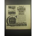
As new towns and cities spread across the American frontier in the nineteenth century, itinerant artists soon followed, documenting these growing urban centers by drawing aerial perspectives, also known as bird's eye views. Commissioned by land speculators, local businesses, civic organizations, and individual citizens, these renderings fostered both civic pride and local commerce. The use of color lithography, a recent invention popularized by such prominent publishers as Currier & Ives, allowed the inexpensive reproduction of the highest-quality drawings, so that a bird's eye view was within the financial budget of even the smallest towns. These extraordinarily detailed lithographs eventually numbered in the thousands and now serve as a rich pictorial record of North America as it stood a century ago. This sequel to our highly acclaimed title An Atlas of Rare City Maps collects over 100 views dating between 1835 and 1902, showing the streets, buildings, churches, bridges, waterways, and surrounding countryside of North American towns, ranging from burgeoning metropolitan centers to small logging towns and mining camps. Baltimore, Brooklyn, Denver, Indianapolis, Memphis, Montreal, New Orleans, Pittsburgh, Seattle, Syracuse, and Washington are just a few of the cities presented in this collection. The exquisite color and fine detail of these bird's eye views have been reproduced in all their original glory; also included is an introduction by John W. Reps providing a background on the artistic process and on urban development in the nineteenth century.
Faultless in every respect. Clean and sharp all around! This magnificent "coffee table" size edition shows many views of cities from the 19th century - examples being Chicago before the Great "O'leary" Fire and San Francisco as it was before the 1906 Earthquake.
Sample pages shown are St. Louis from 1896, Seattle, and New York City.
Listing Information
| Listing Type | Free Listing |
| Listing ID# | 223838786 |
| Start Time | Wed 25 Sep 2024 12:18:58 (EDT) |
| Close Time | 7 days > 1st bid |
| Starting Bid | $24.95 |
| Item Condition | New |
| Bids | 0 |
| Views | 33 |
| Dispatch Time | Next Day |
| Quantity | 1 |
| Location | United States |
| Auto Extend | No |
| Format | Hardcover |
| Special Attributes | Illustrated |
| Subject | Travel, Geography & Exploration |
Seller Recent Feedback
Returns Policy
Returns Accepted