


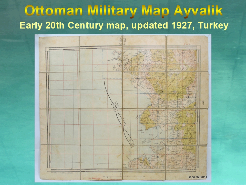
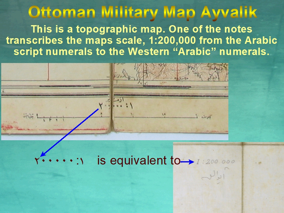
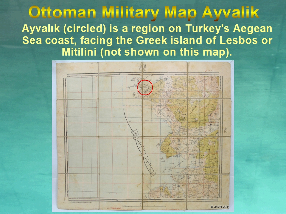
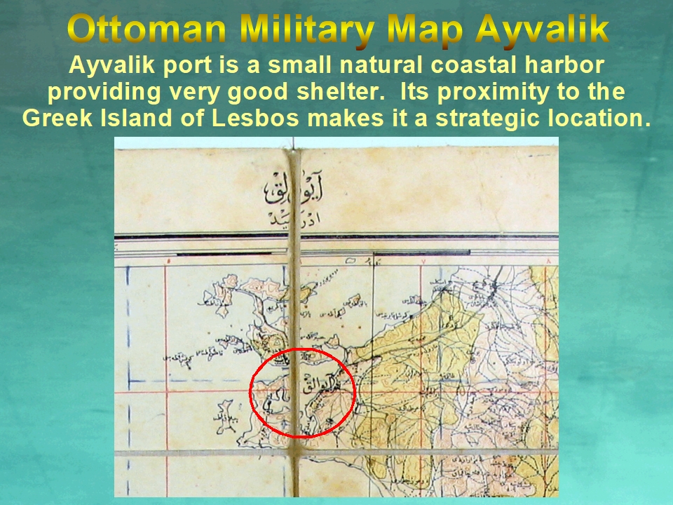
Ottoman Turkish Military Topographic Map of Ayvalik E. 20th Cent. Updated 1927
- Condition : Used
- Dispatch : 4 Days
- Brand : Turkish Military
- ID# : 210381341
- Quantity : 1 item
- Views : 405
- Location : United States

- Seller : europroducts (0)
- Barcode : None
- Start : Sat 24 Sep 2022 00:12:46 (IST)
- Close : 3 days > 1st bid
- Remain : 3 days > 1st bid
Money/Postal Orders, Checks/Cheques
 for 1 item(s) edit
US$2.00 (1,71€) handling fee included.
Shipping Calculator


Seller's Description
Detailed Condtion : In very good, clean condition, minor spotting, light edge wear & toning. Otherwise well preserved, with original folds.
Early Turkish Republic military updated existing Ottoman era maps still using the Arabic script. As per reforms instituted by Ataturk, the Western (Gregorian) calendar was adopted in 1925, & in 1928, the Latin script was adopted.
The revision year on this map is entered in the Gregorian calendar as1927, utilizing the Arabic script ١٩٢٧
Publisher: Ottoman Military, Topographic map.

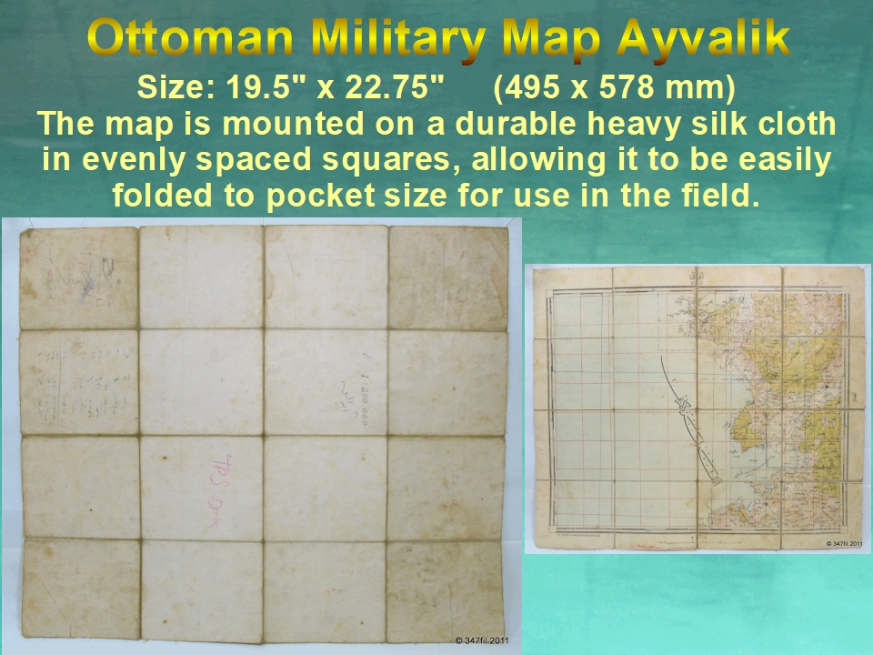

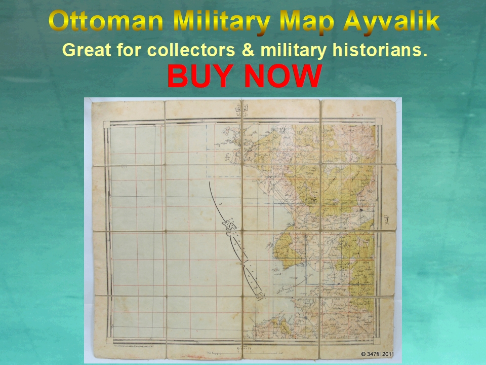
In very good, clean condition, minor spotting, light edge wear & toning. Otherwise well preserved, with original folds.
Please see images, the condition is clearly shown.
International buyers are responsible for knowing their own customs & importation rules with respect to the item(s) being purchased and pay for the customs fees imposed.
All invoices will show the full purchase price of the item(s) being shipped.
Click Link Below To See Our Other Similar Listings:
Listing Information
| Listing Type | Gallery Listing |
| Listing ID# | 210381341 |
| Start Time | Sat 24 Sep 2022 00:12:46 (IST) |
| Close Time | 3 days > 1st bid |
| Starting Bid | US$25.00 (21,36€) |
| Item Condition | Used |
| Bids | 0 |
| Views | 405 |
| Dispatch Time | 4 Days |
| Quantity | 1 |
| Location | United States |
| Auto Extend | No |
Seller Recent Feedback
Returns Policy
Domestic returns only if item is not as described. Not if buyer does not like it or can't afford it. Buyer pays return shipping.
International returns not available. Except only if item is not as described. Buyer pays return shipping.


